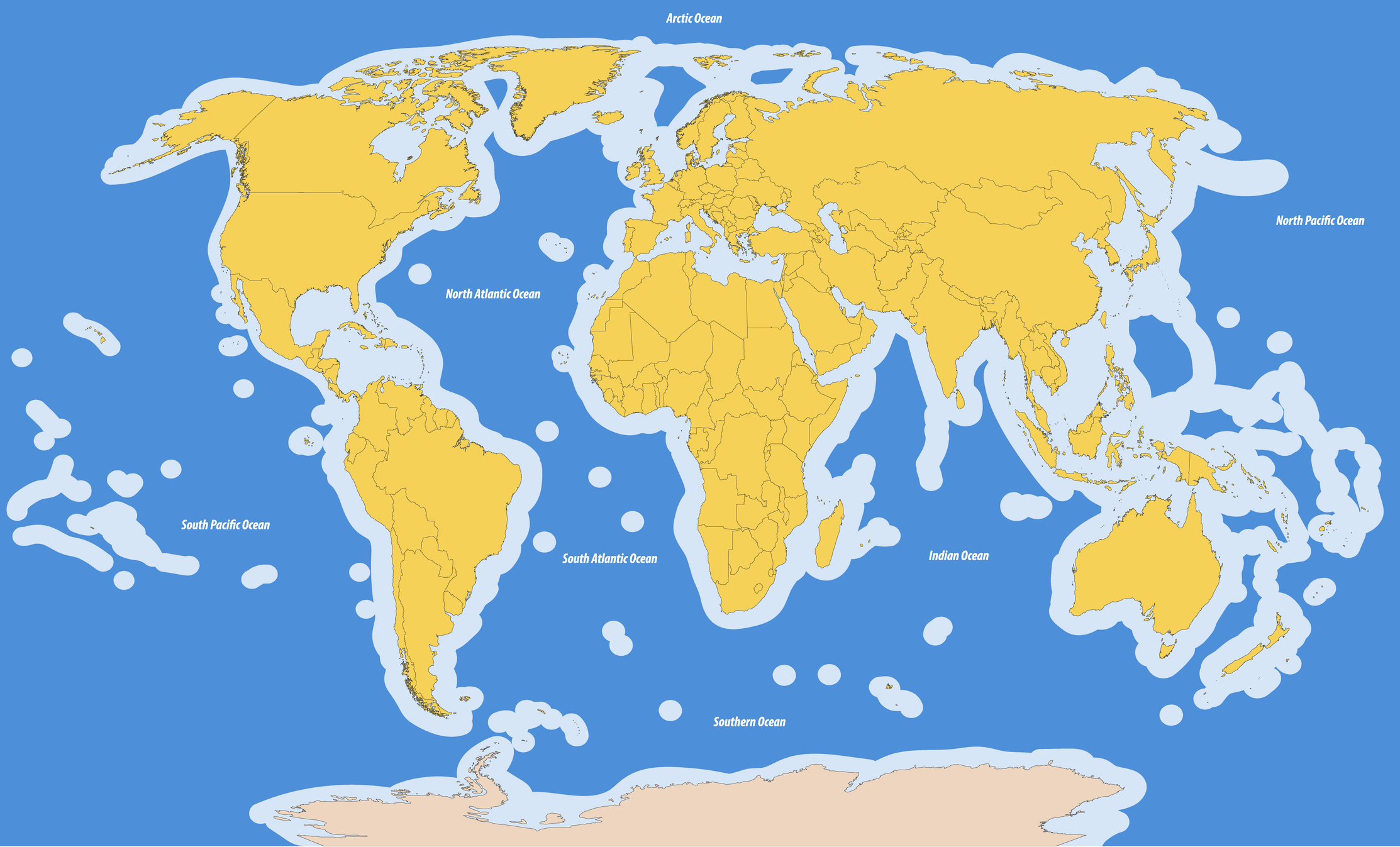
Source: Hofstra University

Source: Flanders Marine Institute (2018). Maritime Boundaries Geodatabase: Maritime Boundaries and Exclusive Economic Zones (200NM), version 10.
 The late 20th century saw a period of new definitions and disputes regarding marine boundaries. Traditionally, each coastal state claimed sovereignty over a territorial sea within a relatively short distance of its coastline. Fishing disputes in the 1970’s led some states to claim a much larger marine territory.
In 1982, the Third United Nations Convention on the Law of the Sea (UNCLOS) set a number of territorial definitions that have been broadly adopted. Full sovereignty is extended to a territorial sea extending 12 nautical miles (about 19 kilometers) from the coast. In addition, control over marine resources is extended to an Exclusive Economic Zone (EEZ) of 200 nautical miles (370 kilometers) beyond the territorial sea of a nation’s coastline (land at lowest tide).
Not surprisingly, this has led to a proliferation of disputes since the EEZs of two or more states frequently overlap, especially where states claim sovereignty to small islands. Since many nations, particularly groups of islands, are in proximity it is common to have EEZs intersect (see above map). There are three main types of EEZ boundaries. Treaty boundaries have been formally recognized by neighboring countries and are thus not contested. Median line boundaries have mainly been established by the UNCLOS convention.
While many have been recognized by the concerned countries, a few are being disputed. In some cases, disputed boundaries led to large areas of disputed EEZ, notably the Spratly Islands on the South China Sea, portions being contested by China, Vietnam, Malaysia and the Philippines. From a transportation perspective, an important distinction is that vessels of other states have the freedom of navigation within the EEZ. While they also have the more restricted right to “innocent passage” through the territorial sea, the coastal state has much greater authority over foreign vessels in that zone.
About Maerospace
Transforming the awareness, assessment, and response to critical economic, environmental, and human threats in national maritime domains
